How the airspace stays safe when drones share it with other aircraft
The airspace above your neighbourhood is not empty. At any given moment it may contain commercial airliners descending to an airport, general aviation aircraft, helicopters, emergency services, weather balloons, and — increasingly — commercial delivery drones. The system that keeps all of these from colliding is one of the great invisible infrastructure achievements of the modern world. Understanding it is essential to understanding why commercial drone delivery has taken as long as it has, and why it is now beginning to scale.
The airspace is divided into layers
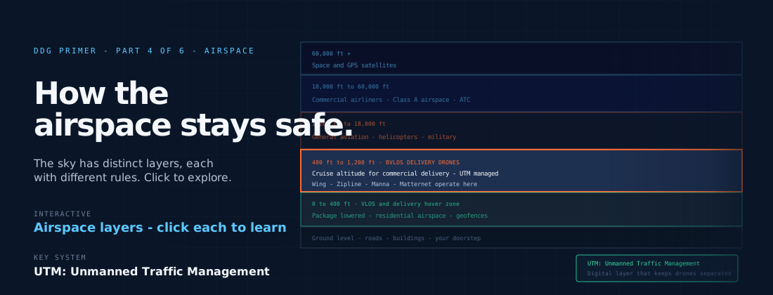
The airspace above any point on the surface is divided into layers, each governed by different rules. At the highest altitudes — above 18,000 feet in the United States — commercial airliners operate in Class A airspace under instrument flight rules, managed by en-route air traffic control centres. Below that, various classes of controlled and uncontrolled airspace accommodate general aviation, helicopters, and other operations.
Delivery drones operate in the lowest layer: below 400 feet above ground level in most regulatory frameworks. This Very Low Level airspace was, until recently, largely unmanaged — it was assumed to be empty except for hobbyist drones and occasional low-level manned operations. Commercial drone delivery changed that assumption entirely.
UTM: the digital airspace management layer
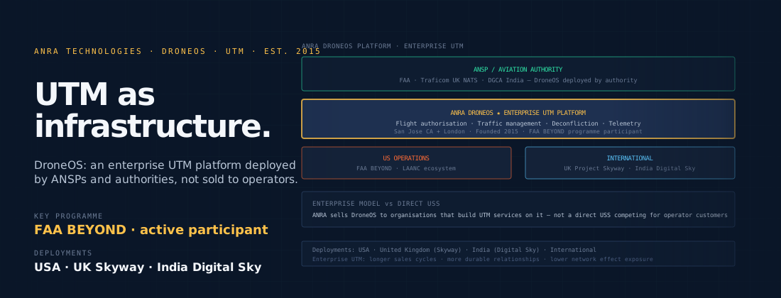
UTM — Unmanned Traffic Management — is the system developed to manage commercial drone operations in the Very Low Level layer. It is not a single piece of infrastructure, like an air traffic control tower. It is a framework of digital services, technical standards, and regulatory requirements that together enable large numbers of drone operations to share low-level airspace safely.
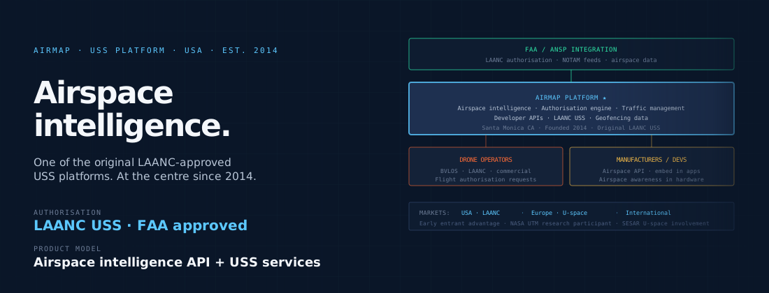
In practice, UTM works through a network of UAS Service Suppliers — USS — that operators connect to. When a drone operator plans a flight, they file a flight plan with their USS. The USS checks the plan against active airspace restrictions (temporary flight restrictions, geofences, areas reserved for emergency services), checks for conflicts with other filed flight plans, and returns an authorisation if the flight can proceed safely. The operator’s aircraft then broadcasts its position throughout the flight, so other USS users can see it.
Remote ID: the digital numberplate
Remote ID is a requirement that commercial drones broadcast their identity and position continuously during flight — the airspace equivalent of a vehicle numberplate. A Remote ID broadcast allows anyone with a suitable receiver — a UTM system, a law enforcement agency, an airport operator — to identify which drone is flying where, and which operator is responsible for it.
Remote ID was mandated in the United States from September 2023, and is required under the EASA framework for drones operating in the EU. It is one of the foundational requirements for commercial BVLOS operations, because without it there is no practical way to manage shared airspace at scale.
How conflicts are prevented
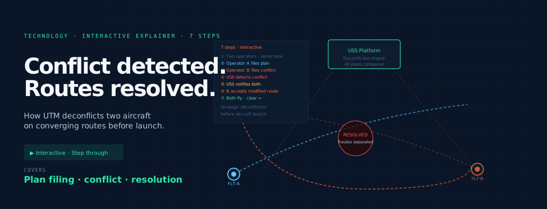
The UTM system prevents two aircraft from occupying the same airspace at the same time through a process called deconfliction. When an operator files a flight plan, the USS compares the planned trajectory against all other filed trajectories in the system. If two trajectories would bring two aircraft into conflict — within defined separation distances of each other — the USS identifies the conflict and alerts the operators before either aircraft launches.
This strategic deconfliction — resolving conflicts at the planning stage — is the primary safety mechanism in current UTM systems. As the density of drone operations increases, tactical deconfliction — managing conflicts that emerge in flight due to deviations from planned routes — becomes increasingly important. This is one of the most active areas of technical development in the UTM sector.
What happens when something goes wrong
Every commercial drone operator is required to define, as part of their regulatory authorisation, what their aircraft does if something goes wrong. Lost communications, GPS failure, battery degradation, system anomalies — all must have defined responses that the aircraft executes autonomously if necessary.
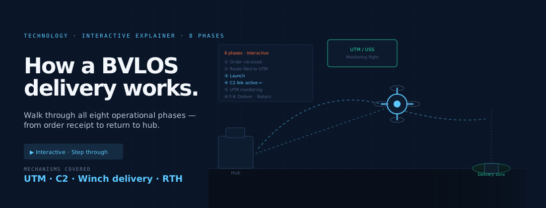
The most common contingency response is return to home: the aircraft automatically navigates back to its hub if contact with the ground control station is lost. This pre-planned contingency route is filed with the UTM system so that other users of the airspace can see it — the aircraft does not simply disappear from the airspace picture when something goes wrong. It follows a known, predictable path that other operators can plan around.