How drone routes are planned: the airspace deconfliction and optimisation behind every delivery
The visible part of a drone delivery is the aircraft in flight. The invisible part — the process by which the aircraft’s route was planned, the airspace was checked, the flight was authorised, and the operation is being monitored — involves a layer of technical and regulatory infrastructure that makes the visible part possible.
Route planning for commercial BVLOS delivery is not a simple point-to-point navigation problem. It involves simultaneous optimisation of multiple objectives — flight safety, airspace compliance, weather avoidance, energy efficiency, delivery speed, and community impact — within constraints set by the aircraft’s performance envelope, the regulatory framework, the airspace environment, and the UTM system.
The pre-flight route planning process
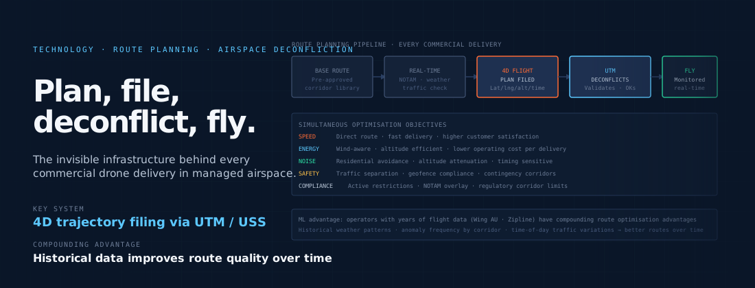
Route planning for a commercial drone delivery typically begins with a base route library — a set of pre-approved corridors between hub and delivery zone clusters that have been assessed for safety, airspace compliance, and obstacle clearance. These base routes represent the operational design space that has been validated as part of the operator’s safety case and operational authorisation: the airspace within which the operator is authorised to fly, with the procedures and performance requirements that authorisation specifies.
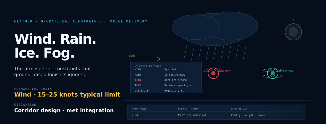
Within the pre-approved corridor structure, real-time route planning adapts each individual flight to current conditions. Active temporary airspace restrictions — NOTAMs, TFRs, emergency response areas — are checked against the proposed route. Weather data is assessed against the aircraft’s operational limits: wind speed and direction, precipitation probability, visibility. The position of other known aircraft — cooperative traffic with transponders, other UTM-tracked flights — is checked for potential conflicts.
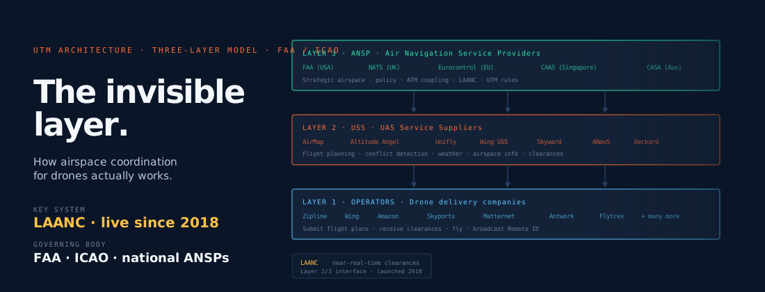
The output of this process is a specific flight plan for the delivery: a four-dimensional trajectory (latitude, longitude, altitude, time) that specifies where the aircraft will be at every point during the flight, within tolerances that reflect the aircraft’s navigation accuracy. This flight plan is filed with the UTM system — the USS — which validates it against all active airspace constraints and returns an authorisation or a conflict notification requiring route modification.
Airspace deconfliction
Airspace deconfliction — ensuring that two aircraft do not occupy the same airspace at the same time — is one of the core functions of UTM. In current commercial drone delivery operations, deconfliction primarily involves separating drone flights from other drone flights and from manned aviation using transponder-based traffic information.
The UTM system maintains a real-time picture of all flights within its coverage area: the four-dimensional trajectories of all authorised drone flights, plus traffic information from ATC about known manned aviation in the relevant airspace. When a new flight plan is filed, the system checks it for conflicts with all existing planned trajectories. If a conflict is detected, the system either suggests an alternative route or returns the conflict to the operator for manual resolution.
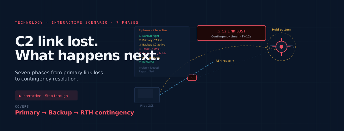
In fully strategic deconfliction — where all conflicts are resolved at the planning stage before any aircraft is airborne — the deconfliction problem is tractable with current technology. The harder problem is tactical deconfliction: resolving conflicts that emerge in flight because of deviations from planned trajectories due to weather, system anomalies, or other operational factors. Tactical deconfliction for multiple simultaneous commercial drone operations in shared airspace is an area of active technical development and regulatory framework design.
Route optimisation objectives
Commercial operators have multiple objectives in route optimisation that are in tension with each other. Minimising flight time — faster delivery — implies more direct routes at higher speeds. Minimising energy consumption — extending battery life and reducing operational costs — implies more efficient aerodynamic routes, potentially avoiding headwinds or altitude changes that increase power demand. Minimising noise impact — reducing community exposure — implies routing away from residential areas where possible, at altitudes that attenuate ground-level noise, with timing that avoids peak residential sensitivity periods.
The weighting of these objectives varies by operator, use case, and operational context. A medical logistics operator delivering time-critical products weights flight time heavily. A consumer retail operator with community relations challenges in its operational area may weight noise impact more heavily. A high-volume operator focused on fleet economics weights energy efficiency as a cost-reduction objective. The route planning system must translate these operator priorities into specific trajectory choices for each flight.
Machine learning in route planning
The volume of historical flight data that accumulated commercial operators have collected — thousands or millions of flights over the operational lifetime of a hub — enables the application of machine learning to route optimisation. Patterns in weather impact on specific corridors, time-of-day variations in airspace complexity, seasonal differences in obstacle risk, and the relationship between route choices and delivery outcomes can all be extracted from operational data to improve future route planning.
The operators with the deepest historical data — Wing in Australia with years of operational history, Zipline with its extensive African and US operational record — have a systematic advantage in route optimisation that newer entrants cannot immediately replicate. The value of operational data for route planning improvement is compounding: more flights produce more data, which produces better routes, which enables more flights. It is one more dimension in which the value of operational time — the industry resource that cannot be purchased — manifests itself.